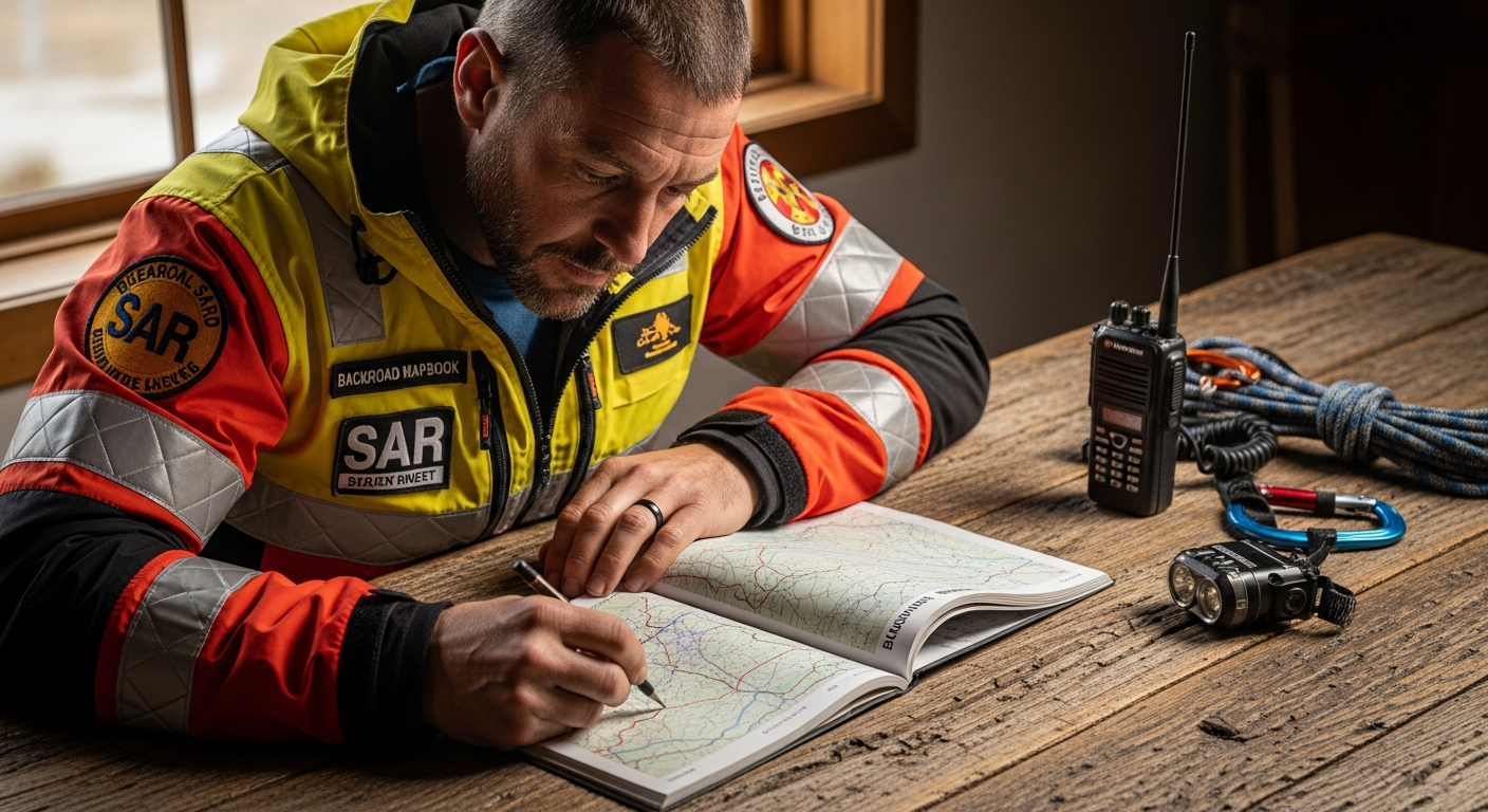
Every year, Canadian search and rescue teams respond to thousands of wilderness emergencies—and when lives hang in the balance, the tools they choose matter enormously. Professional SAR coordinators across the country have standardized on one resource: Backroad Mapbooks printed recreation guidebooks. These aren't casual hiking maps; they're the same spiral-bound tools trusted by emergency responders who need zero room for error.
For over three decades, Backroad Mapbooks has earned its position through relentless commitment to cartographic accuracy and comprehensive detail. While digital mapping solutions dominate consumer conversations, professional teams operating in remote areas where cell signals vanish and batteries die recognize something crucial: a well-designed printed map is irreplaceable infrastructure. When rescue operations depend on navigation tools that function in the harshest conditions imaginable, the choice becomes strategic rather than sentimental.
The Professional Standard for Emergency Navigation
Why Search and Rescue Teams Standardized on Printed Mapbooks Over Digital Alternatives
Search and rescue coordinators face a fundamental question: which navigation tools will deliver results when lives depend on it? The answer, across Canada's provinces and territories, points consistently toward printed Backroad Mapbooks. This standardization didn't happen by accident or tradition—it emerged from operational reality. Digital devices fail in predictable ways: batteries deplete, cellular networks vanish, screens freeze in extreme cold, and software glitches occur precisely when teams need functionality most.
Printed maps eliminate entire categories of failure. They function at minus-40 degrees. They don't require charging ports or network coverage. They're readable after being submerged, dropped, or handled roughly by rescue personnel working under stress. For teams coordinating multi-day operations across vast wilderness areas, this reliability translates directly into operational capacity.
The Liability and Reliability Factors That Drive SAR Equipment Selection
SAR organizations operate within strict accountability frameworks. When a rescue decision leads to an outcome, teams must justify every tool choice and tactic. Printed mapbooks provide institutional confidence because their accuracy is documented, their coverage is comprehensive, and their information doesn't shift based on algorithm updates or corporate policy changes.
The liability calculation is stark: a map that fails during a critical operation carries consequences far beyond the immediate mission. Digital mapping services depend on third-party infrastructure, licensing agreements, and ongoing maintenance by external companies. Printed maps represent a resource that remains static and controllable. SAR teams can verify accuracy, update information systematically, and rely on the same reference materials across multiple operations.
How Cartographic Accuracy Directly Impacts Rescue Mission Success Rates
Precision in terrain representation shapes rescue strategy fundamentally. When a missing person's last known position lies in rugged backcountry, searchers must understand elevation changes, ridge systems, water drainage patterns, and terrain obstacles with exacting detail. Backroad Mapbooks deliver industry-leading topographic relief rendering that reveals these landscape features with clarity that generic mapping products cannot match.
Missing persons respond to terrain in predictable ways. Someone injured and disoriented tends to follow ridgelines or creek beds. Lost hikers typically move downslope. Confused elderly individuals often remain within specific distance bands from their last known location. Rescue planners use detailed topographic maps to predict probable locations and position search teams accordingly. The difference between a map that shows terrain generically and one that renders elevation with precision can mean the difference between finding someone in hours versus days.
The Role of Comprehensive POI Data in Locating Missing Persons and Planning Extraction Routes
Backroad Mapbooks contain thousands of mapped points of interest—hunting camps, fishing lodges, remote cabins, established trail systems, and emergency shelter locations. During active rescue operations, this data transforms from recreational reference into operational intelligence. Search teams investigating whether a missing person might have reached a known shelter rely on comprehensive POI information to guide their efforts.
Extraction planning depends equally on detailed POI mapping. When rescue teams locate an injured person in remote terrain, extraction routes must account for vehicle access, helicopter landing zones, and intermediate support positions. Maps that identify logging roads, industrial roads, and bush roads throughout a region provide rescue coordinators with multiple options for deploying equipment and personnel. The difference between one accessible route and five possible routes expands operational flexibility significantly.
Uncompromising Cartographic Detail for Mission-Critical Operations
Industry-Leading Topographic Relief Rendering and What It Reveals About Terrain Challenges
Topographic representation sits at the core of rescue planning. Backroad Mapbooks employ cartographic standards that exceed typical commercial mapping—they render elevation changes with granularity that reveals terrain features critical to rescue operations. A ridge system shown vaguely on generic maps appears in precise detail on these mapbooks, allowing planners to understand exactly where terrain becomes impassable or where vulnerable individuals might become trapped.
This precision matters operationally because rescue teams must anticipate terrain hazards that could endanger search personnel themselves. Detailed topographic rendering shows cliff faces, talus fields, avalanche-prone slopes, and deep ravines that could injure rescuers or swallow search parties. Understanding terrain this thoroughly allows incident commanders to deploy teams safely while maximizing search coverage.
Extensive Logging Road, Industrial Road, and Bush Road Networks That SAR Teams Use for Vehicle Access
Canadian wilderness contains thousands of miles of resource industry roads that don't appear on standard commercial maps. Logging companies, forestry operations, and industrial enterprises have developed extensive road networks throughout remote regions. Backroad Mapbooks catalog these routes comprehensively—information that becomes invaluable during rescue operations requiring rapid vehicle deployment to remote areas.
A rescue operation that would require days of bushwhacking on foot might be completed in hours with vehicle access to a logging road that's not marked on typical maps. SAR coordinators rely on the detailed road information in Backroad Mapbooks to identify the fastest approach routes to incident locations. This capability has transformed rescue response times across Canada, particularly in regions where terrain restricts travel to established routes.
Trail System Accuracy That Accounts for Seasonal Conditions and Accessibility Barriers
Official hiking trail systems represent only a fraction of the routes people actually travel in Canadian backcountry. Backroad Mapbooks document extensive trail networks including established hiking routes, ATVing tracks, snowmobile corridors, and paddling routes. More importantly, their information reflects seasonal realities: trails that remain accessible year-round versus those impassable during winter, routes affected by washouts or avalanche hazards, and passages that become treacherous under specific conditions.
When rescue teams receive reports of missing persons on backcountry routes, this trail information allows planners to understand exactly which paths were likely traveled and which options for movement exist from the person's last known location. Seasonal trail accessibility data becomes particularly critical during winter operations when certain routes become unusable, fundamentally changing rescue strategy.
How Thousands of Mapped POIs Become Reference Points During Operations
Beyond their primary recreational purpose, the thousands of points of interest documented in Backroad Mapbooks serve as fixed reference coordinates that rescue teams use to communicate, plan, and execute operations. When a searcher radios that they've reached "the cabin marked on map grid reference 47.3, 89.7," they're using POI information to establish their exact position with clarity that would be impossible without comprehensive mapping.
This becomes critical when coordinating multi-team operations across vast areas. POIs serve as rally points, supply caches, medical evacuation sites, and communication hubs. The more comprehensive the POI database, the more operational options rescue coordinators possess when executing complex search and extraction missions.
Reliability When Technology Fails in Remote Terrain
Physical Durability Standards That Withstand Harsh Field Conditions and Repeated Handling
Backroad Mapbooks employ construction standards designed specifically for backcountry use. The spiral-binding withstands repeated opening and closing in harsh conditions. Paper quality resists tearing even when handled roughly by rescue personnel working under stress. The robust 21.5 x 28 cm format remains manageable in field conditions while providing enough surface area for detailed cartography.
Durability becomes non-negotiable in professional rescue operations. A map that degrades after days of field use creates operational liability. Rescue teams need confidence that their navigation resource will function reliably throughout extended operations regardless of weather exposure or handling.
Waterproof Options That Maintain Readability After Exposure to Rain, Snow, and Water Crossings
Waterproof Backroad Mapbooks maintain full readability after exposure to precipitation, submersion, and prolonged moisture contact. This capability transforms maps from fragile reference materials into genuinely field-hardened tools. Rescue operations frequently involve water crossings, river searches, and extended exposure to rain and snow. Standard paper maps become illegible under these conditions; waterproof versions remain fully functional.
The waterproof option represents a deliberate design choice that acknowledges rescue operations occur in uncontrolled environments where equipment exposure is inevitable rather than exceptional.
No Dependency on Batteries, Cellular Coverage, or Internet Connectivity in Wilderness Areas
Digital mapping solutions depend on infrastructure that simply doesn't exist in remote Canadian wilderness. Rescue teams cannot depend on cell coverage that may not be available or may be disrupted. They cannot plan missions assuming battery availability when extended operations might last days. They cannot rely on internet connectivity to update maps or access real-time data.
Printed maps eliminate this entire dependency chain. A Backroad Mapbook functions identically whether the team operates five minutes from the nearest town or fifty kilometers from civilization. This absolute independence from external infrastructure transforms reliability fundamentally.
Legibility Under Low-Light Conditions and Without Requiring Electronic Devices
Rescue operations frequently occur in darkness—nighttime searches, operations in dense forest where light penetration is minimal, or extended missions where teams work through evening hours. Printed maps remain fully readable under any light condition, including headlamp illumination or ambient starlight. Electronic displays become difficult to read in bright sunlight and challenging to use while maintaining night-vision adaptation during darkness.
The simplicity of printed navigation creates operational advantages that digital systems cannot replicate when environmental conditions matter most.
Beyond Recreation: Professional and Institutional Applications
Search and Rescue Team Deployment and Coordination Across Provincial Boundaries
Canadian rescue operations frequently require coordination across provincial jurisdictions where different agencies employ different mapping systems. Backroad Mapbooks provide a common reference framework that allows SAR teams from different provinces to communicate using identical cartographic standards. A team from British Columbia coordinating with Alberta rescue personnel can reference the same map series, eliminating communication confusion that might arise from different digital mapping services.
This standardization becomes particularly valuable during large-scale operations involving multiple agencies and jurisdictions. The consistency of Backroad Mapbooks across all Canadian provinces and territories creates institutional infrastructure that supports inter-agency coordination.
Wildlife Management and Forestry Operations That Require Precise Road and Terrain Mapping
Beyond rescue operations, wildlife management agencies and forestry operations depend on Backroad Mapbooks for professional work requiring precise terrain and road information. Wildlife biologists tracking species movements need accurate trail systems and topographic data. Forestry operations planning harvesting operations require comprehensive road network information. Conservation officers conducting patrols need reliable maps of accessible routes through their territories.
The professional utility of these mapbooks extends far beyond emergency response into the broader ecosystem of Canadian wilderness management.
Emergency Response Planning for Natural Disasters in Remote Canadian Regions
Wildfire season, flooding events, and other natural disasters require emergency response planning that depends on accurate mapping of infrastructure, road access, and terrain features. Backroad Mapbooks provide the detailed reference materials that emergency planners use to develop response protocols for disasters in remote regions. When planning evacuation routes or emergency supply distribution during natural disasters, the comprehensive road and trail information in these mapbooks becomes operationally essential.
Wildfire Management and Evacuation Route Planning Using Detailed Topographic Information
Wildfire response depends critically on understanding terrain and identifying evacuation routes that remain accessible when conditions change rapidly. Backroad Mapbooks provide detailed topographic information and comprehensive road networks that wildfire planners use to design evacuation strategies. The detailed trail system information helps identify alternative routes when primary roads become threatened.
The Enduring Foundation of Wilderness Safety
When examining the landscape of Canadian outdoor navigation, one reality stands out: professional rescue teams haven't abandoned printed maps because they offer something digital tools simply cannot replicate—absolute reliability when stakes are highest. Backroad Mapbooks printed recreation guidebooks have earned their place in SAR operations through consistent delivery of the cartographic precision, comprehensive detail, and unwavering dependability that emergency responders demand. These spiral-bound guidebooks represent a proven, battle-tested approach to navigation that has directly contributed to successful rescue outcomes across decades and thousands of operations.
Professional rescue operations don't view printed maps versus digital solutions as an either-or decision. Instead, they recognize that comprehensive printed maps form the foundational layer of navigation strategy, supported by digital tools that enhance rather than replace them. The extensive road networks, detailed trail systems, thousands of POIs, and topographic precision packed into each mapbook create a reference resource that remains invaluable regardless of technological advancement.
If you're involved in search and rescue operations, emergency management, backcountry professional work, or wilderness expedition planning, evaluating Backroad Mapbooks as part of your navigation infrastructure makes strategic sense. Start by identifying which regional mapbooks cover your operational areas, assess how they integrate with your existing digital systems, and consider them as critical components of a redundant, resilient navigation strategy.
Start building your professional navigation infrastructure with Backroad Mapbooks today.
Leave a Reply